山と高原地図
Category : Travel and Navigation
Author Name : 山と高原地図
Operating System : android
License : Free
Rating : Everyone
山と高原地図 Download Links for Android
山と高原地図 Screenshot
About 山と高原地図 Android Application
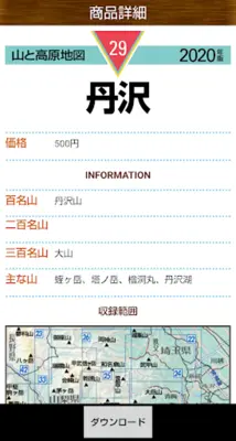
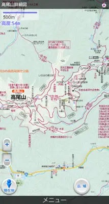
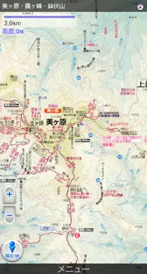
山と高原地図 is a digital map app for climbers and outdoor enthusiasts that offers detailed topographical maps for 61 regions in Japan. It includes clear mountaineering data, course times, water sources, and notable flora along trails. The app also allows users to track and record routes, and share them with others.
Application Official Website
https://www.mapple.co.jp/product/yamachizuappApplication Support Email
[email protected]Application Main Features
- Provides the most up-to-date topographical maps for 61 regions.
- Offers detailed course times, locations of water sources, and noteworthy flora along the trails.
- Downloadable and free Mt. Takao map as a taster of the application's capabilities.
- Purchased maps remain current for the remainder of the year, with the option to acquire updated versions in subsequent years.
- Effortless transfer of purchased maps within the same Google account.
- Pre-downloaded maps and GPS integration allow for device use in airplane mode to conserve battery life.
- Ability to track and record routes, with options to share them via email or by posting on climbing community sites.
- Covers approximately 1,500 notable peaks across Japan, including all of Japan's 100 famous mountains.
- Requires supported OS version 4.0 or higher.
- GPS capabilities are necessary for displaying current location and recording routes.
Application Ratings
4.2
1
2
3
4
5
The content is rewritten by Gemini Ai ,Published Date : 22/2/2024 , Modified Date : 22/2/2024
